
|
What is Biodiversity Net Gain?
Biodiversity Net Gain (BNG) is an approach to development, land and marine management that leaves biodiversity in a measurably better state than before the development took place. It aims to create new habitat as well as enhance existing habitats, ensuring the ecological connectivity they provide for wildlife is retained and improved. To be successful high quality biodiversity data will be required for the evidence base and will have to be collected, collated and managed for the life time of the BNG projects. LERCs are ideally placed to be a part of delivering BNG. LERC Services for BNG
Metric Calculations As holders of the best quality data for their area, it is logical that LERCs also provide a service to calculate the biodiversity value of a given location’s baseline habitat data using the Defra metric, alongside any local variations that may be required by local and regional planning authorities. Creation and Maintenance of GIS Based Site Registers
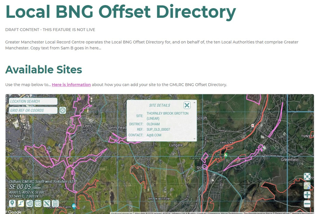
© Greater Manchester RLC: BNG Sites Register prototype (Feb 2023).BNG Reporting
LERC processes include independent verification of information and datasets that are then used to underpin reporting. Local reporting to national standards would enable local statistics to feed into the national reporting system. Reports could include:
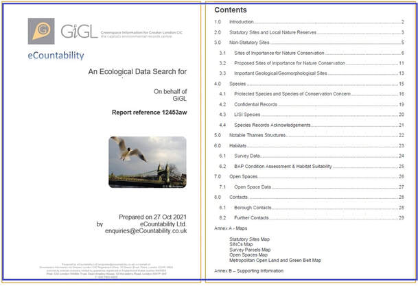
© GIGL: Ecological Data Search Report.
|
ALERC:
Context Setting LERC data search reports provide everything the LERC knows about the site within the red line boundary, and a buffer of 1 or 2km (or more) to inform net gain project design and preconstruction. This includes, where available, green infrastructure, habitats (including condition and extent) and species (protected, priority, invasive, non-native, etc.), as well as designated sites and in future will include any known biodiversity offsetting opportunities or completions. It is possible, at least to start with, that rigorous habitat / green space data aren’t available for all counties, so LERCs could collaborate to generate a baseline using remote sensing data and aerial photographs that has biodiversity units already calculated. 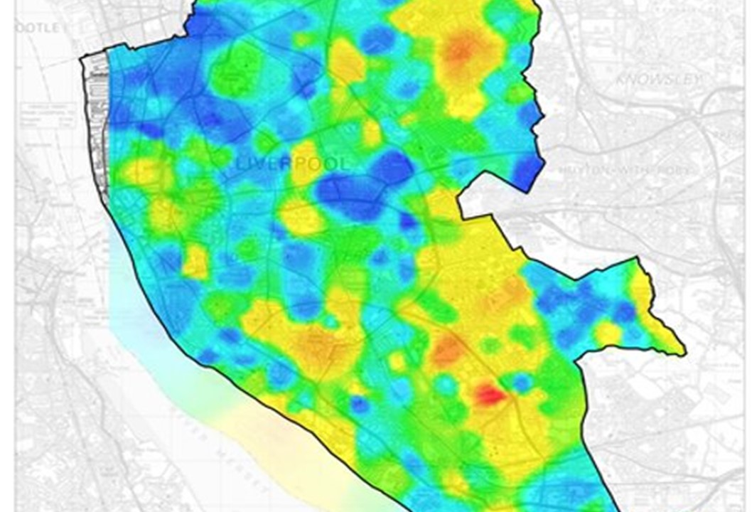
© Merseyside BioBank:Biodiversity hotspots in Liverpool.(red = high biodiversity, blue=low biodiversity).Generation, Management and Improvement of County-Wide Green Infrastructure, Habitat, and Species
LERCs are well-placed to oversee and deliver all aspects of data generation, management and analysis in relation to biodiversity net gain in their area, from initial site assessments to establish the biodiversity baseline plus related unit calculations, to the ongoing surveys that inform site management and monitor a project’s progress towards target. Ecological, Network and Opportunities Mapping A modelled Geographical Information System (GIS) dataset that helps strategically plan net gain in the LERC’s area and eliminate potential for bias towards particular land managers / owners. Where ecological network mapping hasn’t been undertaken it’s likely many LERCs will work with local stakeholders to collate and analyse existing data to create new resources such as habitat suitability mapping and biodiversity opportunity areas. 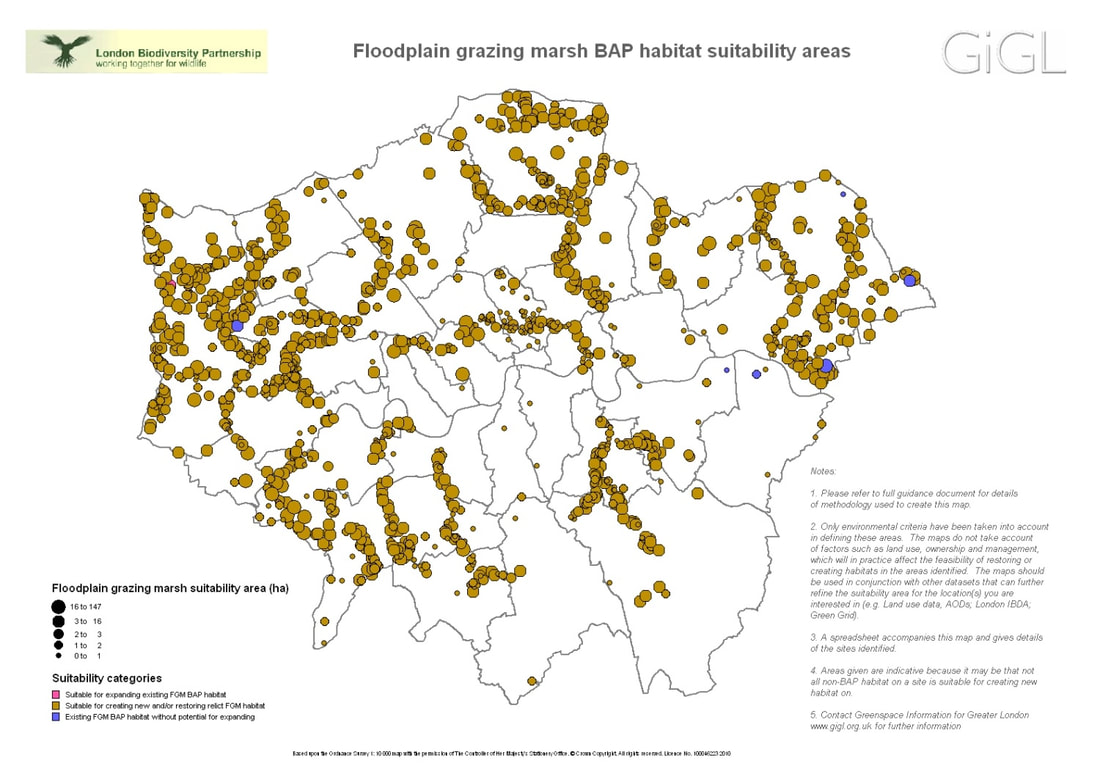
© GIGL: BAP habitat suitability map. (https://www.gigl.org.uk/our-data-holdings/habitat-data/bap-habitat-suitability-data/)
|
Download: LERCs Helping Deliver BNG